When you consider that New York State has been battered by close to 100 tropical and subtropical cyclones, nor’easters and other powerful storms since the 17th Century, it’s a wonder Long Island still exists. Yet, if you look at old maps and charts, except for the locations of inlets, the new maps and charts don’t look very different from the old ones. Dealing with the outcomes of storms was easier in the old days before Long Island became a popular place to live and work and residential building started covering waterfront areas. Once people built houses on or near the water, storm tide and surge damage became so expensive to fix, that repairs and replacements became insurance issues.
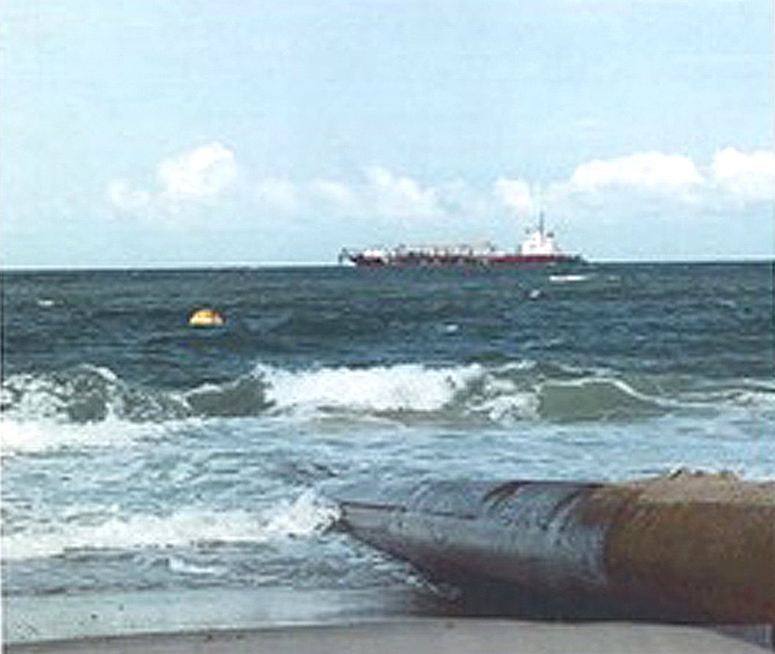
In 1922 after the subway system in New York City expanded to Brooklyn, the beach nourishment program started up, bringing sand in from offshore to enlarge and improve Coney Island and a million visitors a day came to enjoy the beach. It was said to be the first beach nourishment program of its kind. Later projects replaced sand but at Coney Island, the added sand was to expand the size of the beach. Groins and jetties along the shoreline kept 1,700,000 cubic yards of added sand in place. At the time the trip on the subway to Brooklyn cost 5 cents. At Coney Island they could swim in the ocean, relax, sun themselves on a towel or a beach blanket, rent an umbrella, have a hot dog or two at Nathan’s Famous or go on a 5-cent roller coaster ride (the first roller coaster in the US). On a good day, they could do all these things. They didn’t have to leave if it started to rain, the amusement area was enclosed. By adding sand to the existing beach and properties bought from private owners plus the extension of the subway, what started as a small farming community in Brooklyn became a seaside playground for the masses. Six states (California, Florida, New Jersey, New York, North Carolina and Louisiana) accounted for most of the sand volume used to repair beaches. How is the sand usually found? It is dredged and pumped from offshore to the beach where it is needed or poured from previously dredged sand stored in a temporary “borrow” area. With the rise in sea level, homeowners at Westhampton Beach on a barrier island watched over the years as the ocean seemed to get closer to their houses with every storm. When the homeowners appealed to the politicians for help, the Army Corps of Engineers built groins from 1966 to 1970 when the program ran out of money. The project was never finished. The design of the groins they put in place was flawed. The groins were too long. They stuck out in the surf too far. They were too closely spaced. In the groin area, the beach became so over nourished some of the homeowners lost their ocean views. Others, unprotected by the groins, lost their houses. The lawsuits started in the late 1970s and continued through the 1980s but nothing was done to solve the problem. While the Army Corps “fix” was called the “Westhampton Beach Disaster,” it had a plus side. The fresh supply of clean ocean water coming into the bay improved clamming in the area. The 1992 nor’easter that closed highways and parts of the New York City Subway and Port Authority Systems did an estimated 750 million dollars in damage. The slow-moving storm destroyed over 100 homes on Long Island and created new inlets. The storm eroded sand from the Fire Island dune areas and other barrier beaches. Some of the worst damage was caused by the loss of sand. Dunes provide a natural barrier to the destructive forces of wind and waves. It was time to get the stalled program, “Fire Island Inlet to Montauk Point Coastal Storm Risk Management Project” up and running again. This project manages the risks of coastal storm damage and sea level risk for barrier islands and back bay communities on Long Island’s south shore. The more developed the south shore of Long Island became, the more expensive and difficult it became to protect it as the climate change and the number and intensity of storms increase, it is estimated that the over 40,000 houses and businesses plus schools, hospitals, firehouses and police stations are in the area to be managed. The Coastal Storm Risk Management Project will not only manage the risks of coastal storm damage, the project will have a breach response plan, coastal restoration plans, home elevation, flood proofing and means to protect natural resources. This summer the Great Lakes Dredge & Dock Company co-existed on the beach and in the water at Avon, a North Carolina shore community, with the tourists. The dredge and sand pumping are part of a 24/7 operation that enables Great Lakes to tightly schedule their work in the area. The company planned to head down shore with their dredge to begin work in Buxton and was sending another dredge to Avon. Only about five companies have the equipment and capability to do this beach nourishment work. For the most part, the workers and the vacationers get used to working around each other except for an occasional delay for beach drivers who need to wait for the Great Lakes equipment to be moved.The goal of the beach nourishment at Avon is not to protect oceanfront houses from the surf, but to protect the highway. Ten years ago, the houses were behind two rows of vegetated dunes. Now the dunes are gone and when they have a flood tide the water flows over the highway – NC Highway 12 –and creates a barrier between the rest of the barrier islands and northern Avon. Sections of Highway 12 were shredded by Hurricane Irene in 2011. Researchers working in England and Australia are looking at erosion from extreme storms and finding it isn’t always lose-lose in the sand area. Extreme storm waves sometimes stir up the sediment and push it toward the shore. Using small planes, drones, jet skis with echo sounders and time-lapse videos they were able to capture the exact amount of sand volume added to the beach. In New Jersey when sand is bulldozed up onto the beach, some call it “welfare for the wealthy,” and they mean those who own Jersey shore oceanfront houses that benefit when they add sand to public beaches. New Jersey has 127 miles of shoreline, most of it developed and mixed with the beaches are some expensive houses on the ocean. Probably billions of people come to the Jersey shore every year so there isn’t much choice whether to keep up the beaches. People all over question the cost of importing sand to replace what storms and erosion have taken away. When you try to balance the costs and the benefits, it goes beyond protecting a string of oceanfront houses. Roads need to be functional and barrier beaches need to be there to protect the mainland. Whole neighborhoods of houses that are now either bay front or canal front would be on the ocean without the barrier beaches. On Long Island if you didn’t support the barrier beaches you’d lose the shellfish industry, which seems to be responding well to the attention it’s getting from Stony Brook University and coming back to life.